
Thank you for supporting this site ❤️
Make a donation
Make a donation
Yalding topographic map
Click on the map to display elevation.
Thank you for supporting this site ❤️
Make a donation
Make a donation
About this map
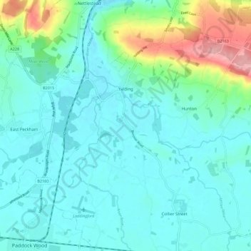
Name: Yalding topographic map, elevation, terrain.
Location: Yalding, Maidstone, Kent, England, United Kingdom (51.17940 0.38323 51.24883 0.45687)
Average elevation: 32 m
Minimum elevation: 7 m
Maximum elevation: 134 m
Thank you for supporting this site ❤️
Make a donation
Make a donation
Other topographic maps
Click on a map to view its topography, its elevation and its terrain.