
Westfield Sole topographic map
Interactive map
Click on the map to display elevation.
About this map
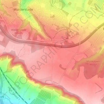
Name: Westfield Sole topographic map, elevation, terrain.
Average elevation: 145 m
Minimum elevation: 33 m
Maximum elevation: 199 m
Other topographic maps
Click on a map to view its topography, its elevation and its terrain.
Yalding
United Kingdom > England > Kent > Maidstone
Yalding, Maidstone, Kent, England, United Kingdom
Average elevation: 32 m
Boughton Monchelsea
United Kingdom > England > Kent > Maidstone
Boughton Monchelsea, Maidstone, Kent, England, United Kingdom
Average elevation: 64 m
Thurnham
United Kingdom > England > Kent > Maidstone
Thurnham, Maidstone, Kent, South East England, England, United Kingdom
Average elevation: 113 m