
Thank you for supporting this site ❤️
Make a donation
Make a donation
Pershore topographic map
Click on the map to display elevation.
Thank you for supporting this site ❤️
Make a donation
Make a donation
About this map
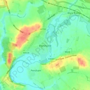
Name: Pershore topographic map, elevation, terrain.
Location: Pershore, Wychavon, Worcestershire, England, United Kingdom (52.08781 -2.11137 52.13224 -2.05688)
Average elevation: 26 m
Minimum elevation: 10 m
Maximum elevation: 57 m
Thank you for supporting this site ❤️
Make a donation
Make a donation
Other topographic maps
Click on a map to view its topography, its elevation and its terrain.