Geolocate

Havant topographic map

Interactive map

Click on the map to display elevation.

About this map

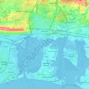
Name: Havant topographic map, elevation, terrain.

Location: Havant, Hampshire, England, United Kingdom (50.77124 -1.05490 50.89541 -0.92647)

Average elevation: 14 m

Minimum elevation: -5 m

Maximum elevation: 106 m

Other topographic maps

Click on a map to view its topography, its elevation and its terrain.

Hayling Island

United Kingdom > England > Hampshire > Havant > North Hayling

Hayling Island, North Hayling, Havant, Hampshire, England, United Kingdom

Average elevation: 1 m