
Tipi Valley topographic map
Interactive map
Click on the map to display elevation.
About this map
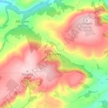
Name: Tipi Valley topographic map, elevation, terrain.
Location: Tipi Valley, Carmarthenshire, Wales, SA32 7UQ, United Kingdom (51.94298 -4.04953 51.98298 -4.00953)
Average elevation: 216 m
Minimum elevation: 75 m
Maximum elevation: 327 m
Other topographic maps
Click on a map to view its topography, its elevation and its terrain.