
Hamilton County topographic map
Interactive map
Click on the map to display elevation.
About this map
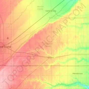
Name: Hamilton County topographic map, elevation, terrain.
Location: Hamilton County, Nebraska, United States of America (40.69814 -98.28293 41.17334 -97.82450)
Average elevation: 544 m
Minimum elevation: 490 m
Maximum elevation: 598 m
Other topographic maps
Click on a map to view its topography, its elevation and its terrain.
Colfax County
United States of America > Nebraska
Colfax County, Nebraska, United States of America
Average elevation: 452 m
Kearney County
United States of America > Nebraska
Kearney County, Nebraska, United States of America
Average elevation: 653 m