
York County topographic map
Interactive map
Click on the map to display elevation.
About this map
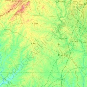
Name: York County topographic map, elevation, terrain.
Location: York County, South Carolina, United States (34.82042 -81.49239 35.16488 -80.86524)
Average elevation: 193 m
Minimum elevation: 104 m
Maximum elevation: 458 m
Other topographic maps
Click on a map to view its topography, its elevation and its terrain.