
Thank you for supporting this site ❤️
Make a donation
Make a donation
Magarini topographic map
Click on the map to display elevation.
Thank you for supporting this site ❤️
Make a donation
Make a donation
About this map
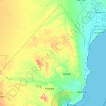
Name: Magarini topographic map, elevation, terrain.
Location: Magarini, Kilifi County, Kenya (-3.32134 39.15334 -2.31166 40.24169)
Average elevation: 109 m
Minimum elevation: -1 m
Maximum elevation: 522 m
Thank you for supporting this site ❤️
Make a donation
Make a donation