
Make a donation
Camberley topographic map
Click on the map to display elevation.
Make a donation
Camberley
The Staff College, to the north of Camberley town centre, is part of the Joint Services Command and Staff College, which provides training and education for established officers in the British Armed Forces and civil servants in the Ministry of Defence. The institution has its origins in the Royal Military College, High Wycombe, which was founded in 1799. It moved to Farnham in 1813, relocating seven years later to the Royal Military College at Sandhurst. The Staff College building was designed by James Pennethorne and constructed in 1862. It was primarily built using London stock bricks, although the front elevation is partially faced with stone. The uppermost storey was added in 1913.
Make a donation
About this map
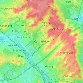
Name: Camberley topographic map, elevation, terrain.
Average elevation: 88 m
Minimum elevation: 53 m
Maximum elevation: 137 m
Make a donation
Other topographic maps
Click on a map to view its topography, its elevation and its terrain.