
Thank you for supporting this site ❤️
Make a donation
Make a donation
Nasipit topographic map
Click on the map to display elevation.
Thank you for supporting this site ❤️
Make a donation
Make a donation
About this map
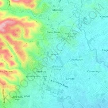
Name: Nasipit topographic map, elevation, terrain.
Location: Nasipit, Cebu City, Central Visayas, 6014, Philippines (10.33297 123.89581 10.37297 123.93581)
Average elevation: 57 m
Minimum elevation: 8 m
Maximum elevation: 201 m
Thank you for supporting this site ❤️
Make a donation
Make a donation
Other topographic maps
Click on a map to view its topography, its elevation and its terrain.