
Thank you for supporting this site ❤️
Make a donation
Make a donation
Sambag II topographic map
Click on the map to display elevation.
Thank you for supporting this site ❤️
Make a donation
Make a donation
About this map
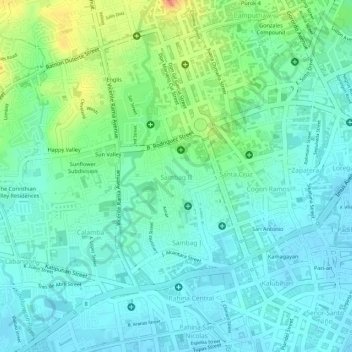
Name: Sambag II topographic map, elevation, terrain.
Location: Sambag II, Cebu City, Central Visayas, Philippines (10.30249 123.88686 10.30932 123.89530)
Average elevation: 20 m
Minimum elevation: 4 m
Maximum elevation: 55 m
Thank you for supporting this site ❤️
Make a donation
Make a donation
Other topographic maps
Click on a map to view its topography, its elevation and its terrain.