
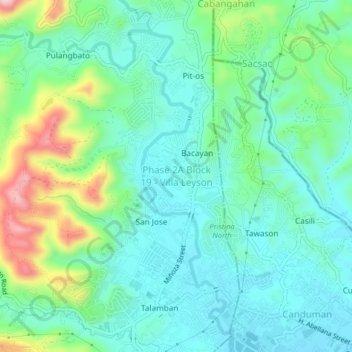
Phase 2A Block 19 - Villa Leyson topographic map
Interactive map
Click on the map to display elevation.
Phase 2A Block 19 - Villa Leyson topographic map, elevation, terrain
About this map
Name: Phase 2A Block 19 - Villa Leyson topographic map, elevation, terrain.
Average elevation: 83 m
Minimum elevation: 21 m
Maximum elevation: 260 m
Other topographic maps
Click on a map to view its topography, its elevation and its terrain.