
Sula topographic map
Interactive map
Click on the map to display elevation.
About this map
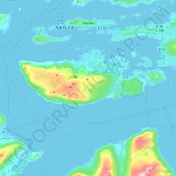
Name: Sula topographic map, elevation, terrain.
Location: Sula, Møre og Romsdal, Noruega (62.36669 6.01195 62.45898 6.37596)
Average elevation: 86 m
Minimum elevation: -6 m
Maximum elevation: 1,149 m
Other topographic maps
Click on a map to view its topography, its elevation and its terrain.