
Des Moines topographic map
Interactive map
Click on the map to display elevation.
About this map
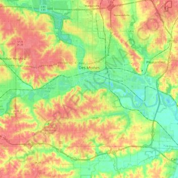
Name: Des Moines topographic map, elevation, terrain.
Location: Des Moines, Polk County, Iowa, United States (41.47964 -93.70914 41.65891 -93.49369)
Average elevation: 265 m
Minimum elevation: 229 m
Maximum elevation: 303 m
Other topographic maps
Click on a map to view its topography, its elevation and its terrain.