
Thank you for supporting this site ❤️
Make a donation
Make a donation
Logan County topographic map
Click on the map to display elevation.
Thank you for supporting this site ❤️
Make a donation
Make a donation
About this map
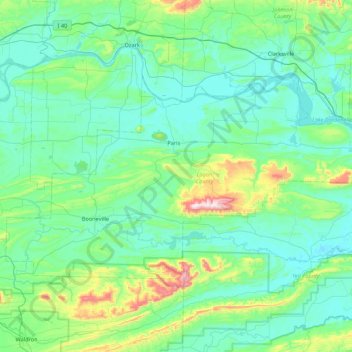
Name: Logan County topographic map, elevation, terrain.
Location: Logan County, Arkansas, United States (35.01973 -94.14179 35.42996 -93.27803)
Average elevation: 201 m
Minimum elevation: 92 m
Maximum elevation: 833 m
Thank you for supporting this site ❤️
Make a donation
Make a donation
Other topographic maps
Click on a map to view its topography, its elevation and its terrain.