
Thank you for supporting this site ❤️
Make a donation
Make a donation
Hopewell topographic map
Click on the map to display elevation.
Thank you for supporting this site ❤️
Make a donation
Make a donation
About this map
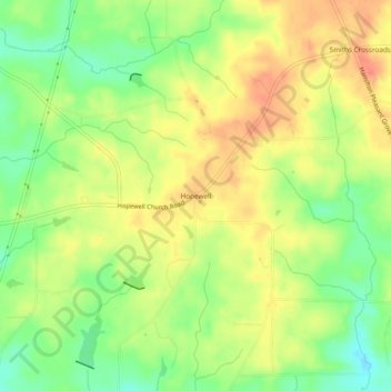
Name: Hopewell topographic map, elevation, terrain.
Location: Hopewell, Harris County, Georgia, United States (32.80263 -84.97410 32.84263 -84.93410)
Average elevation: 244 m
Minimum elevation: 214 m
Maximum elevation: 269 m
Thank you for supporting this site ❤️
Make a donation
Make a donation
Other topographic maps
Click on a map to view its topography, its elevation and its terrain.