
The Borough District of Clonmel topographic map
Interactive map
Click on the map to display elevation.
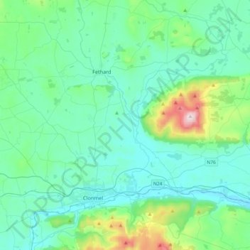
The Borough District of Clonmel topographic map, elevation, terrain
About this map
Name: The Borough District of Clonmel topographic map, elevation, terrain.
Average elevation: 118 m
Minimum elevation: 5 m
Maximum elevation: 716 m
Other topographic maps
Click on a map to view its topography, its elevation and its terrain.