
Thank you for supporting this site ❤️
Make a donation
Make a donation
Marion County topographic map
Click on the map to display elevation.
Thank you for supporting this site ❤️
Make a donation
Make a donation
About this map
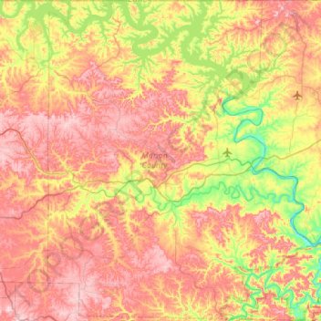
Name: Marion County topographic map, elevation, terrain.
Location: Marion County, Arkansas, United States (36.06270 -92.89070 36.49859 -92.40694)
Average elevation: 269 m
Minimum elevation: 116 m
Maximum elevation: 420 m
Thank you for supporting this site ❤️
Make a donation
Make a donation
Other topographic maps
Click on a map to view its topography, its elevation and its terrain.