
Make a donation
Sukabumi topographic map
Click on the map to display elevation.
Make a donation
Sukabumi
At an altitude of approximately 584 m (1,916 ft), the city is a minor hill station resort, with a cooler climate than the surrounding lowlands. The area around Sukabumi is also a popular destination for whitewater rafting. Tea and Rubber production is a major industry in the area. The suburban area surrounding Sukabumi circling the mountain has grown tremendously in population, such that northern Sukabumi Regency, hugging the volcano, and bordering Greater Jakarta, is home to the bulk of the regency's population.
Make a donation
About this map
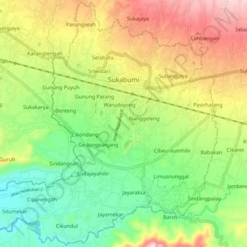
Name: Sukabumi topographic map, elevation, terrain.
Location: Sukabumi, West Java, Java, Indonesia (-6.97892 106.87167 -6.89242 106.96017)
Average elevation: 570 m
Minimum elevation: 387 m
Maximum elevation: 831 m
Make a donation
Other topographic maps
Click on a map to view its topography, its elevation and its terrain.