
Thank you for supporting this site ❤️
Make a donation
Make a donation
Tutukaka topographic map
Click on the map to display elevation.
Thank you for supporting this site ❤️
Make a donation
Make a donation
About this map
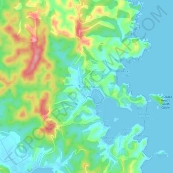
Name: Tutukaka topographic map, elevation, terrain.
Location: Tutukaka, Whangārei District, Northland, New Zealand (-35.62833 174.50443 -35.58833 174.54443)
Average elevation: 36 m
Minimum elevation: -2 m
Maximum elevation: 130 m
Whangarei District trails, hiking, mountain biking, running and outdoor activities
Thank you for supporting this site ❤️
Make a donation
Make a donation
Other topographic maps
Click on a map to view its topography, its elevation and its terrain.