
Thank you for supporting this site ❤️
Make a donation
Make a donation
静宁县 topographic map
Click on the map to display elevation.
Thank you for supporting this site ❤️
Make a donation
Make a donation
About this map
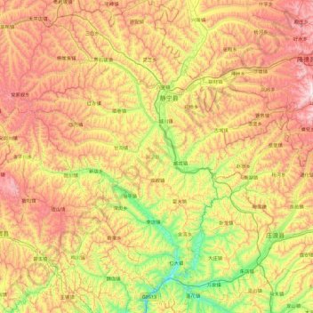
Name: 静宁县 topographic map, elevation, terrain.
Location: 静宁县, 平凉市, Gansu, China (35.02038 105.34369 35.74970 106.09591)
Average elevation: 1,847 m
Minimum elevation: 1,332 m
Maximum elevation: 2,513 m
Thank you for supporting this site ❤️
Make a donation
Make a donation
Other topographic maps
Click on a map to view its topography, its elevation and its terrain.
Thank you for supporting this site ❤️
Make a donation
Make a donation