
Thank you for supporting this site ❤️
Make a donation
Make a donation
Lahul topographic map
Click on the map to display elevation.
Thank you for supporting this site ❤️
Make a donation
Make a donation
About this map
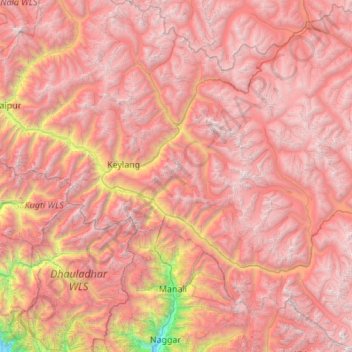
Name: Lahul topographic map, elevation, terrain.
Location: Lahul, Lahaul and Spiti District, Himachal Pradesh, India (32.08076 76.77993 32.99818 77.81359)
Average elevation: 4,551 m
Minimum elevation: 1,476 m
Maximum elevation: 6,490 m
Thank you for supporting this site ❤️
Make a donation
Make a donation
Other topographic maps
Click on a map to view its topography, its elevation and its terrain.