
Perry County topographic map
Click on the map to display elevation.
About this map
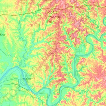
Name: Perry County topographic map, elevation, terrain.
Location: Perry County, Indiana, United States (37.84143 -86.81324 38.26445 -86.43052)
Average elevation: 166 m
Minimum elevation: 109 m
Maximum elevation: 268 m
Other topographic maps
Click on a map to view its topography, its elevation and its terrain.
Indiana Dunes State Park
United States > Indiana > Porter County > Chesterton
Average elevation: 186 m
Drexel Gardens
United States > Indiana > Marion County > Indianapolis > Drexel Gardens
Average elevation: 226 m