Geolocate
👉 Easily get elevation data in JSON, GeoTIFF and KML formats using Elevation API
Thank you for supporting this site ❤️
Make a donation

Corbridge topographic map

Click on the map to display elevation.

👉 Easily get elevation data in JSON, GeoTIFF and KML formats using Elevation API
Thank you for supporting this site ❤️
Make a donation

About this map

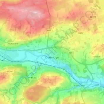
Name: Corbridge topographic map, elevation, terrain.

Location: Corbridge, Northumberland, North East, England, United Kingdom (54.93080 -2.08167 55.02721 -1.95633)

Average elevation: 128 m

Minimum elevation: 18 m

Maximum elevation: 281 m

Other topographic maps

Click on a map to view its topography, its elevation and its terrain.

Langley

United Kingdom > England > Northumberland

Average elevation: 246 m

Ninebanks

United Kingdom > England > Northumberland

Average elevation: 341 m

Ridsdale

United Kingdom > England > Northumberland

Average elevation: 240 m