
Yaxley topographic map
Interactive map
Click on the map to display elevation.
About this map
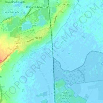
Name: Yaxley topographic map, elevation, terrain.
Average elevation: 6 m
Minimum elevation: -5 m
Maximum elevation: 38 m
Other topographic maps
Click on a map to view its topography, its elevation and its terrain.
Huntingdonshire
United Kingdom > England > Huntingdonshire
Huntingdonshire, Cambridgeshire, East of England, England, United Kingdom
Average elevation: 32 m
Farcet
United Kingdom > England > Huntingdonshire > Farcet
Farcet, Huntingdonshire, Cambridgeshire, East of England, England, PE7 3AA, United Kingdom
Average elevation: 9 m