
Thank you for supporting this site ❤️
Make a donation
Make a donation
Lutayan topographic map
Click on the map to display elevation.
Thank you for supporting this site ❤️
Make a donation
Make a donation
About this map
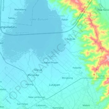
Name: Lutayan topographic map, elevation, terrain.
Location: Lutayan, Sultan Kudarat, Soccsksargen, 9803, Philippines (6.53743 124.76727 6.67282 124.93223)
Average elevation: 73 m
Minimum elevation: 6 m
Maximum elevation: 616 m
Thank you for supporting this site ❤️
Make a donation
Make a donation
Other topographic maps
Click on a map to view its topography, its elevation and its terrain.