
Thank you for supporting this site ❤️
Make a donation
Make a donation
Cataula topographic map
Click on the map to display elevation.
Thank you for supporting this site ❤️
Make a donation
Make a donation
About this map
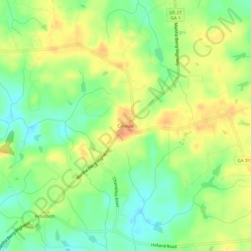
Name: Cataula topographic map, elevation, terrain.
Location: Cataula, Harris County, Georgia, 31804, United States (32.63541 -84.88854 32.67541 -84.84854)
Average elevation: 197 m
Minimum elevation: 174 m
Maximum elevation: 220 m
Thank you for supporting this site ❤️
Make a donation
Make a donation
Other topographic maps
Click on a map to view its topography, its elevation and its terrain.