
Thank you for supporting this site ❤️
Make a donation
Make a donation
Pawlett topographic map
Click on the map to display elevation.
Thank you for supporting this site ❤️
Make a donation
Make a donation
About this map
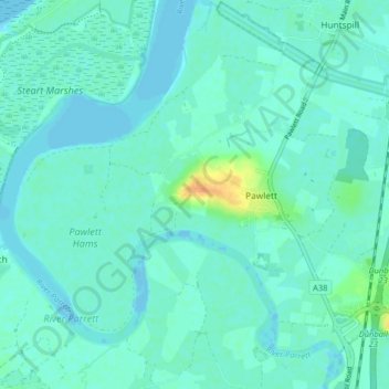
Name: Pawlett topographic map, elevation, terrain.
Location: Pawlett, Somerset, England, United Kingdom (51.16289 -3.05903 51.20090 -2.97844)
Average elevation: 6 m
Minimum elevation: -8 m
Maximum elevation: 34 m
Thank you for supporting this site ❤️
Make a donation
Make a donation
Other topographic maps
Click on a map to view its topography, its elevation and its terrain.