
Little Budworth topographic map
Interactive map
Click on the map to display elevation.
About this map
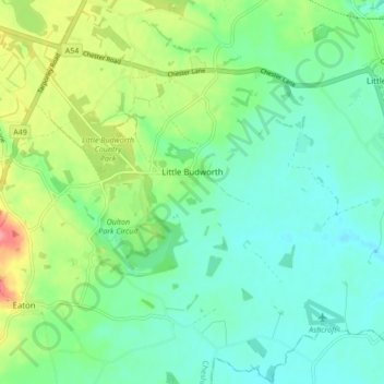
Name: Little Budworth topographic map, elevation, terrain.
Average elevation: 61 m
Minimum elevation: 36 m
Maximum elevation: 119 m
Other topographic maps
Click on a map to view its topography, its elevation and its terrain.
Davenham
United Kingdom > England > Cheshire West and Chester > Bostock Green
Davenham, Bostock Green, Cheshire West and Chester, England, United Kingdom
Average elevation: 32 m
Winsford
United Kingdom > England > Cheshire West and Chester > Winsford
Winsford, Cheshire West and Chester, England, United Kingdom
Average elevation: 45 m