
Thank you for supporting this site ❤️
Make a donation
Make a donation
Ohuka topographic map
Click on the map to display elevation.
Thank you for supporting this site ❤️
Make a donation
Make a donation
About this map
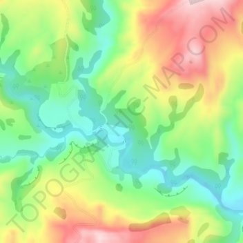
Name: Ohuka topographic map, elevation, terrain.
Location: Ohuka, Wairoa District, Hawke's Bay, 4195, New Zealand (-38.82523 177.28710 -38.80523 177.30710)
Average elevation: 238 m
Minimum elevation: 117 m
Maximum elevation: 402 m
Wairoa District trails, hiking, mountain biking, running and outdoor activities
Thank you for supporting this site ❤️
Make a donation
Make a donation
Other topographic maps
Click on a map to view its topography, its elevation and its terrain.