
Datong City topographic map
Click on the map to display elevation.
Datong City
Datong is a prefecture-level city in northern Shanxi Province in the People's Republic of China. It is located in the Datong Basin at an elevation of 1,040 metres (3,410 ft) and borders Inner Mongolia to the north and west and Hebei to the east. As of the 2020 census, it had a population of 3,105,591 of whom 1,790,452 lived in the built-up (or metro) area made of the 2 out 4 urban districts of Pingcheng and Yungang as Yunzhou and Xinrong are not conurbated yet.
About this map
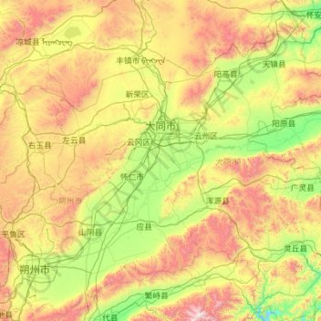
Name: Datong City topographic map, elevation, terrain.
Location: Datong City, Shanxi, China (39.04845 112.57067 40.74496 114.56551)
Average elevation: 1,339 m
Minimum elevation: 690 m
Maximum elevation: 3,029 m
Other topographic maps
Click on a map to view its topography, its elevation and its terrain.