
Make a donation
Wayne County topographic map
Click on the map to display elevation.
Make a donation
Wayne County
According to the 2010 census, the county has a total area of 404.34 square miles (1,047.2 km2), of which 401.74 square miles (1,040.5 km2) (or 99.36%) is land and 2.60 square miles (6.7 km2) (or 0.64%) is water. Wayne County includes Indiana's highest natural elevation, Hoosier Hill, at 1,257 feet (383 m).
Make a donation
About this map
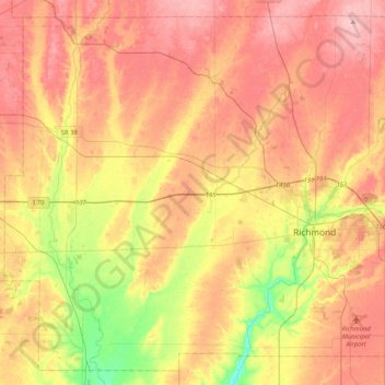
Name: Wayne County topographic map, elevation, terrain.
Location: Wayne County, Indiana, United States (39.71477 -85.22151 40.00626 -84.81071)
Average elevation: 322 m
Minimum elevation: 240 m
Maximum elevation: 385 m
Make a donation
Other topographic maps
Click on a map to view its topography, its elevation and its terrain.
Make a donation
Indiana Dunes State Park
United States > Indiana > Porter County > Chesterton
Average elevation: 186 m
Drexel Gardens
United States > Indiana > Marion County > Indianapolis > Drexel Gardens
Average elevation: 226 m
Make a donation