
Thank you for supporting this site ❤️
Make a donation
Make a donation
Antelope Peak topographic map
Click on the map to display elevation.
Thank you for supporting this site ❤️
Make a donation
Make a donation
About this map
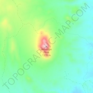
Name: Antelope Peak topographic map, elevation, terrain.
Location: Antelope Peak, Pinal County, Arizona, United States (32.85085 -110.86099 32.85095 -110.86089)
Average elevation: 1,184 m
Minimum elevation: 1,107 m
Maximum elevation: 1,367 m
Thank you for supporting this site ❤️
Make a donation
Make a donation
Other topographic maps
Click on a map to view its topography, its elevation and its terrain.