
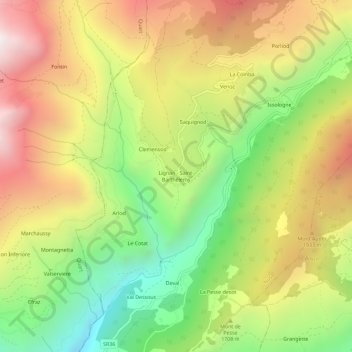
Lignan - Saint-Barthélemy topographic map
Interactive map
Click on the map to display elevation.
About this map
Name: Lignan - Saint-Barthélemy topographic map, elevation, terrain.
Average elevation: 1,680 m
Minimum elevation: 939 m
Maximum elevation: 2,475 m
Other topographic maps
Click on a map to view its topography, its elevation and its terrain.
Freideron
Italië > Valle d'Aosta > Nus > Reche
Freideron, Reche, Nus, Valle d'Aosta, Italië
Average elevation: 2,378 m
Le Rascar
Italië > Valle d'Aosta > Nus
Le Rascar, Lo Rascar, Nus, Valle d'Aosta, 11020, Italië
Average elevation: 2,010 m