
Stjørdal topographic map
Interactive map
Click on the map to display elevation.
About this map
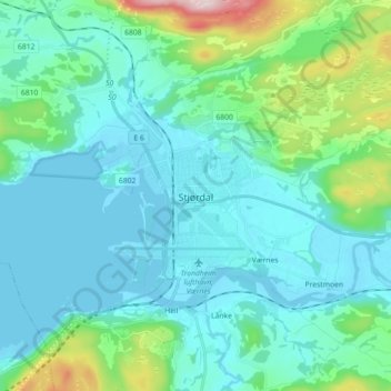
Name: Stjørdal topographic map, elevation, terrain.
Location: Stjørdal, Trøndelag, 7500, Norway (63.42836 10.88395 63.50836 10.96395)
Average elevation: 71 m
Minimum elevation: -3 m
Maximum elevation: 437 m
Other topographic maps
Click on a map to view its topography, its elevation and its terrain.