
Agusan Marsh Wildlife Sanctuary topographic map
Interactive map
Click on the map to display elevation.
About this map
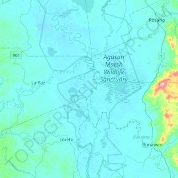
Name: Agusan Marsh Wildlife Sanctuary topographic map, elevation, terrain.
Average elevation: 36 m
Minimum elevation: 9 m
Maximum elevation: 443 m
Other topographic maps
Click on a map to view its topography, its elevation and its terrain.
Sibagat
Sibagat is located at 8°49′N 125°41′E / 8.82°N 125.69°E / 8.82; 125.69. Elevation of most areas of the municipality sit atop 100 meters above sea level (M.a.s.l.).
Average elevation: 384 m