
Poladpur topographic map
Interactive map
Click on the map to display elevation.
About this map
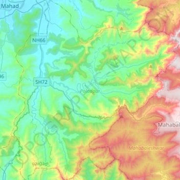
Name: Poladpur topographic map, elevation, terrain.
Location: Poladpur, Raigad, Maharashtra, 402303, India (17.85072 73.42597 18.08781 73.65865)
Average elevation: 419 m
Minimum elevation: 1 m
Maximum elevation: 1,399 m
Other topographic maps
Click on a map to view its topography, its elevation and its terrain.