Rell topographic map
Interactive map
Click on the map to display elevation.
About this map
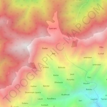
Name: Rell topographic map, elevation, terrain.
Location: Rell, Chamba, Chamba District, Himachal Pradesh, 176311, India (32.50351 76.22632 32.54351 76.26632)
Average elevation: 2,432 m
Minimum elevation: 1,469 m
Maximum elevation: 3,057 m
Other topographic maps
Click on a map to view its topography, its elevation and its terrain.
Khajjiar
India > Himachal Pradesh > Chamba
Khajjiar, Chamba, Chamba District, Himachal Pradesh, India
Average elevation: 1,868 m
Chamba Jot
India > Himachal Pradesh > Chamba
Chamba Jot, Chamba, Chamba District, Himachal Pradesh, India
Average elevation: 2,191 m
Kankot
India > Himachal Pradesh > Chamba
Kankot, Chamba, Himachal Pradesh, India
Average elevation: 3,611 m