
Kisubi topographic map
Interactive map
Click on the map to display elevation.
About this map
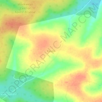
Name: Kisubi topographic map, elevation, terrain.
Location: Kisubi, Nakaseke, Central Region, Uganda (0.91333 32.28000 0.95333 32.32000)
Average elevation: 1,100 m
Minimum elevation: 1,074 m
Maximum elevation: 1,118 m
Other topographic maps
Click on a map to view its topography, its elevation and its terrain.