
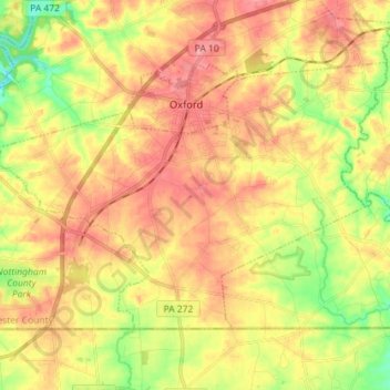
East Nottingham Township topographic map
Interactive map
Click on the map to display elevation.
About this map
Name: East Nottingham Township topographic map, elevation, terrain.
Average elevation: 137 m
Minimum elevation: 74 m
Maximum elevation: 190 m
Other topographic maps
Click on a map to view its topography, its elevation and its terrain.
West Chester
United States > Pennsylvania > Chester County
West Chester, Chester County, Pennsylvania, 19383, United States
Average elevation: 126 m
Whiteland Crest
United States > Pennsylvania > Chester County > West Whiteland Township > Exton
Whiteland Crest, Exton, West Whiteland Township, Chester County, Pennsylvania, 19381, United States
Average elevation: 127 m
Phoenixville
United States > Pennsylvania > Chester County
Phoenixville, Chester County, Pennsylvania, United States
Average elevation: 55 m
Malvern
United States > Pennsylvania > Chester County
Malvern, Chester County, Pennsylvania, 19355, United States
Average elevation: 153 m
Downingtown
United States > Pennsylvania > Chester County
Downingtown, Chester County, Pennsylvania, 19335, United States
Average elevation: 106 m
Pottstown Landing
United States > Pennsylvania > Chester County > North Coventry Township
Pottstown Landing, North Coventry Township, Chester County, Pennsylvania, 19465, United States
Average elevation: 66 m
West Pikeland Township
United States > Pennsylvania > Chester County
West Pikeland Township, Chester County, Pennsylvania, 19425, United States
Average elevation: 127 m
Kemblesville
United States > Pennsylvania > Chester County > Franklin Township
Kemblesville, Franklin Township, Chester County, Pennsylvania, 19347, United States
Average elevation: 104 m
flood plane
United States > Pennsylvania > Chester County > Uwchlan Township > Lionville
flood plane, Lionville, Uwchlan Township, Chester County, Pennsylvania, United States
Average elevation: 149 m
Nottingham
United States > Pennsylvania > Chester County > West Nottingham Township
Nottingham, West Nottingham Township, Chester County, Pennsylvania, 19362, United States
Average elevation: 145 m
Brandamore
United States > Pennsylvania > Chester County > West Brandywine Township
Brandamore, West Brandywine Township, Chester County, Pennsylvania, 19316, United States
Average elevation: 191 m
Lionville
United States > Pennsylvania > Chester County > Uwchlan Township
Lionville, Uwchlan Township, Chester County, Pennsylvania, 19381, United States
Average elevation: 149 m
Cochranville
United States > Pennsylvania > Chester County > West Fallowfield Township
Cochranville, West Fallowfield Township, Chester County, Pennsylvania, 19330, United States
Average elevation: 170 m
Warwick
United States > Pennsylvania > Chester County > Warwick Township
Warwick, Warwick Township, Chester County, Pennsylvania, 19520, United States
Average elevation: 185 m
Chatwood
United States > Pennsylvania > Chester County > West Goshen Township
Chatwood, West Goshen Township, Chester County, Pennsylvania, 19392, United States
Average elevation: 129 m
Goshenville
United States > Pennsylvania > Chester County > East Goshen Township
Goshenville, East Goshen Township, Chester County, Pennsylvania, 19360, United States
Average elevation: 132 m
Darlington Corners
United States > Pennsylvania > Chester County > Thornbury Township > Westtown
Darlington Corners, Westtown, Thornbury Township, Chester County, Pennsylvania, 19382, United States
Average elevation: 111 m
Cedarville
United States > Pennsylvania > Chester County > North Coventry Township
Cedarville, North Coventry Township, Chester County, Pennsylvania, 19465, United States
Average elevation: 82 m
Pughtown
United States > Pennsylvania > Chester County > South Coventry Township
Pughtown, South Coventry Township, Chester County, Pennsylvania, 19421, United States
Average elevation: 122 m
Embreeville
United States > Pennsylvania > Chester County > Newlin Township
Embreeville, Newlin Township, Chester County, Pennsylvania, 19308, United States
Average elevation: 107 m
Thorndale
United States > Pennsylvania > Chester County > Caln Township
Thorndale, Caln Township, Chester County, Pennsylvania, 19372, United States
Average elevation: 129 m
Hamorton
United States > Pennsylvania > Chester County > Kennett Township
Hamorton, Kennett Township, Chester County, Pennsylvania, 19340, United States
Average elevation: 118 m
West Grove
United States > Pennsylvania > Chester County
West Grove, Chester County, Pennsylvania, United States
Average elevation: 128 m
South Coatesville
United States > Pennsylvania > Chester County
South Coatesville, Chester County, Pennsylvania, 13920, United States
Average elevation: 131 m
Suplee
United States > Pennsylvania > Chester County > Honey Brook Township
Suplee, Honey Brook Township, Chester County, Pennsylvania, 19344, United States
Average elevation: 203 m
Saint Peters
United States > Pennsylvania > Chester County > Warwick Township
Saint Peters, Warwick Township, Chester County, Pennsylvania, United States
Average elevation: 157 m
Hallman
United States > Pennsylvania > Chester County > East Pikeland Township
Hallman, East Pikeland Township, Chester County, Pennsylvania, 19442, United States
Average elevation: 94 m
Faggs Manor
United States > Pennsylvania > Chester County > Londonderry Township
Faggs Manor, Londonderry Township, Chester County, Pennsylvania, 19330, United States
Average elevation: 177 m
Unionville
United States > Pennsylvania > Chester County > East Marlborough Township
Unionville, East Marlborough Township, Chester County, Pennsylvania, 19375, United States
Average elevation: 134 m
Springdell
United States > Pennsylvania > Chester County > West Marlborough Township
Springdell, West Marlborough Township, Chester County, Pennsylvania, United States
Average elevation: 132 m
Lyndell
United States > Pennsylvania > Chester County > East Brandywine Township
Lyndell, East Brandywine Township, Chester County, Pennsylvania, 19354, United States
Average elevation: 137 m
Icedale
United States > Pennsylvania > Chester County > West Brandywine Township
Icedale, West Brandywine Township, Chester County, Pennsylvania, 19316, United States
Average elevation: 198 m
Hayti
United States > Pennsylvania > Chester County > Valley Township
Hayti, Valley Township, Chester County, Pennsylvania, 13920, United States
Average elevation: 151 m
Steelville
United States > Pennsylvania > Chester County > West Fallowfield Township
Steelville, West Fallowfield Township, Chester County, Pennsylvania, 17509, United States
Average elevation: 164 m
Mendenhall
United States > Pennsylvania > Chester County > Kennett Township
Mendenhall, Kennett Township, Chester County, Pennsylvania, 19357, United States
Average elevation: 110 m
Ludwigs Corner
United States > Pennsylvania > Chester County > West Vincent Township
Ludwigs Corner, West Vincent Township, Chester County, Pennsylvania, 19480, United States
Average elevation: 182 m
Lenape
United States > Pennsylvania > Chester County > Pocopson Township > Pocopson
Lenape, Pocopson, Pocopson Township, Chester County, Pennsylvania, 19366, United States
Average elevation: 79 m
Isabella
United States > Pennsylvania > Chester County > West Nantmeal Township
Isabella, West Nantmeal Township, Chester County, Pennsylvania, 19520, United States
Average elevation: 200 m
Hickory Hill
United States > Pennsylvania > Chester County > Elk Township
Hickory Hill, Elk Township, Chester County, Pennsylvania, 19352, United States
Average elevation: 123 m
Compass
United States > Pennsylvania > Chester County > West Caln Township
Compass, West Caln Township, Chester County, Pennsylvania, United States
Average elevation: 186 m
Eagleview
United States > Pennsylvania > Chester County > Uwchlan Township
Eagleview, Uwchlan Township, Chester County, Pennsylvania, 19480, United States
Average elevation: 151 m
Nantmeal Village
United States > Pennsylvania > Chester County > East Nantmeal Township
Nantmeal Village, East Nantmeal Township, Chester County, Pennsylvania, United States
Average elevation: 171 m
Mortonville
United States > Pennsylvania > Chester County > East Fallowfield Township
Mortonville, East Fallowfield Township, Chester County, Pennsylvania, 19358, United States
Average elevation: 122 m
London Grove
United States > Pennsylvania > Chester County > West Marlborough Township
London Grove, West Marlborough Township, Chester County, Pennsylvania, 19374, United States
Average elevation: 131 m
Knauertown
United States > Pennsylvania > Chester County > Warwick Township
Knauertown, Warwick Township, Chester County, Pennsylvania, United States
Average elevation: 151 m
Ironsides
United States > Pennsylvania > Chester County > Schuylkill Township
Ironsides, Schuylkill Township, Chester County, Pennsylvania, 19460, United States
Average elevation: 61 m
Harmonyville
United States > Pennsylvania > Chester County > Warwick Township
Harmonyville, Warwick Township, Chester County, Pennsylvania, United States
Average elevation: 175 m
Toughkenamon
United States > Pennsylvania > Chester County > New Garden Township
Toughkenamon, New Garden Township, Chester County, Pennsylvania, 19374, United States
Average elevation: 115 m
Whitford
United States > Pennsylvania > Chester County > West Whiteland Township
Whitford, West Whiteland Township, Chester County, Pennsylvania, 19341, United States
Average elevation: 122 m
Wagontown
United States > Pennsylvania > Chester County > West Caln Township
Wagontown, West Caln Township, Chester County, Pennsylvania, 19320, United States
Average elevation: 166 m