
Three Rivers topographic map
Click on the map to display elevation.
About this map
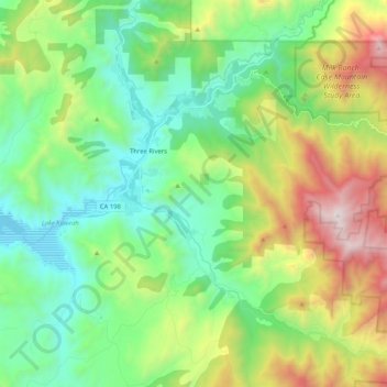
Name: Three Rivers topographic map, elevation, terrain.
Location: Three Rivers, Tulare County, California, United States (36.33704 -118.95522 36.50384 -118.80355)
Average elevation: 762 m
Minimum elevation: 186 m
Maximum elevation: 2,056 m
Other topographic maps
Click on a map to view its topography, its elevation and its terrain.