
Thank you for supporting this site ❤️
Make a donation
Make a donation
Johnsondale topographic map
Click on the map to display elevation.
Thank you for supporting this site ❤️
Make a donation
Make a donation
About this map
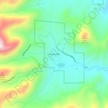
Name: Johnsondale topographic map, elevation, terrain.
Location: Johnsondale, Tulare County, California, United States (35.95467 -118.56092 35.99467 -118.52092)
Average elevation: 1,565 m
Minimum elevation: 1,374 m
Maximum elevation: 1,986 m
Thank you for supporting this site ❤️
Make a donation
Make a donation
Other topographic maps
Click on a map to view its topography, its elevation and its terrain.