
Thank you for supporting this site ❤️
Make a donation
Make a donation
Woodlake topographic map
Click on the map to display elevation.
Thank you for supporting this site ❤️
Make a donation
Make a donation
About this map
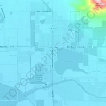
Name: Woodlake topographic map, elevation, terrain.
Location: Woodlake, Tulare County, California, 93286, United States (36.39393 -119.13470 36.42827 -119.08090)
Average elevation: 146 m
Minimum elevation: 127 m
Maximum elevation: 474 m
Thank you for supporting this site ❤️
Make a donation
Make a donation
Other topographic maps
Click on a map to view its topography, its elevation and its terrain.