
Thank you for supporting this site ❤️
Make a donation
Make a donation
Toxibó topographic map
Click on the map to display elevation.
Thank you for supporting this site ❤️
Make a donation
Make a donation
About this map
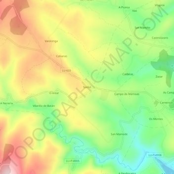
Name: Toxibó topographic map, elevation, terrain.
Location: Toxibó, Gonzar, Portomarín, Lugo, Galicia, 27188, España (42.79284 -7.68470 42.83284 -7.64470)
Average elevation: 476 m
Minimum elevation: 332 m
Maximum elevation: 640 m
Thank you for supporting this site ❤️
Make a donation
Make a donation
Other topographic maps
Click on a map to view its topography, its elevation and its terrain.