
Thank you for supporting this site ❤️
Make a donation
Make a donation
Devils Staircase topographic map
Click on the map to display elevation.
Thank you for supporting this site ❤️
Make a donation
Make a donation
About this map
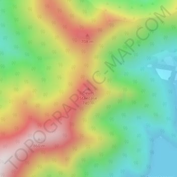
Name: Devils Staircase topographic map, elevation, terrain.
Location: Devils Staircase, Marlborough, New Zealand (-41.08227 173.85014 -41.08217 173.85024)
Average elevation: 372 m
Minimum elevation: 0 m
Maximum elevation: 852 m
Marlborough trails, hiking, mountain biking, running and outdoor activities
Thank you for supporting this site ❤️
Make a donation
Make a donation
Other topographic maps
Click on a map to view its topography, its elevation and its terrain.