
Acheron River (Malborough) topographic map
Interactive map
Click on the map to display elevation.
About this map
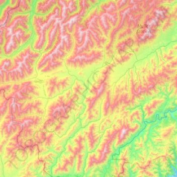
Name: Acheron River (Malborough) topographic map, elevation, terrain.
Location: Acheron River (Malborough), Marlborough, New Zealand (-42.39312 172.96428 -41.92588 173.32236)
Average elevation: 1,219 m
Minimum elevation: 401 m
Maximum elevation: 2,175 m
Marlborough trails, hiking, mountain biking, running and outdoor activities
Other topographic maps
Click on a map to view its topography, its elevation and its terrain.