
Thank you for supporting this site ❤️
Make a donation
Make a donation
Canvastown topographic map
Click on the map to display elevation.
Thank you for supporting this site ❤️
Make a donation
Make a donation
About this map
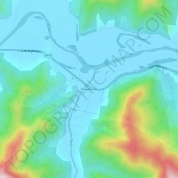
Name: Canvastown topographic map, elevation, terrain.
Location: Canvastown, Marlborough, New Zealand (-41.31117 173.65043 -41.27117 173.69043)
Average elevation: 133 m
Minimum elevation: 4 m
Maximum elevation: 626 m
Marlborough trails, hiking, mountain biking, running and outdoor activities
Thank you for supporting this site ❤️
Make a donation
Make a donation
Other topographic maps
Click on a map to view its topography, its elevation and its terrain.