
Thank you for supporting this site ❤️
Make a donation
Make a donation
Division No. 15 topographic map
Click on the map to display elevation.
Thank you for supporting this site ❤️
Make a donation
Make a donation
About this map
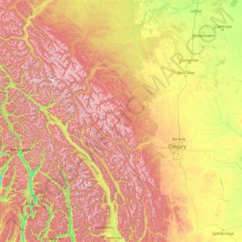
Name: Division No. 15 topographic map, elevation, terrain.
Location: Division No. 15, Alberta, Canada (49.49474 -119.54484 53.48118 -114.00046)
Average elevation: 1,395 m
Minimum elevation: 386 m
Maximum elevation: 3,430 m
Thank you for supporting this site ❤️
Make a donation
Make a donation
Other topographic maps
Click on a map to view its topography, its elevation and its terrain.
Thank you for supporting this site ❤️
Make a donation
Make a donation
Thank you for supporting this site ❤️
Make a donation
Make a donation