
سقارة topographic map
Interactive map
Click on the map to display elevation.
About this map
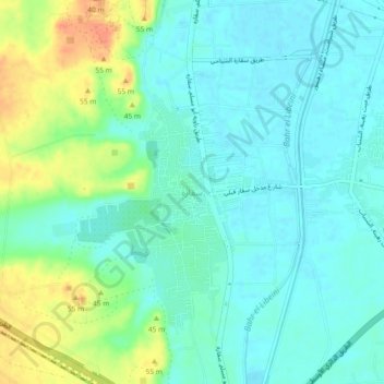
Name: سقارة topographic map, elevation, terrain.
Location: سقارة, Guiza, 12919, Egipto (29.83034 31.20828 29.87034 31.24828)
Average elevation: 31 m
Minimum elevation: 18 m
Maximum elevation: 62 m
Other topographic maps
Click on a map to view its topography, its elevation and its terrain.
Menfis y su necrópolis – Zonas de las pirámides desde Guizeh hasta Dahshur
Menfis y su necrópolis – Zonas de las pirámides desde Guizeh hasta Dahshur, Guiza, Egipto
Average elevation: 69 m