
Thank you for supporting this site ❤️
Make a donation
Make a donation
Tetbury topographic map
Click on the map to display elevation.
Thank you for supporting this site ❤️
Make a donation
Make a donation
About this map
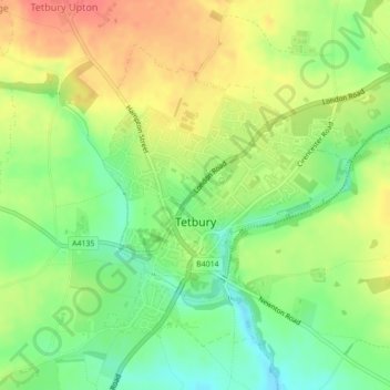
Name: Tetbury topographic map, elevation, terrain.
Average elevation: 122 m
Minimum elevation: 91 m
Maximum elevation: 156 m
Thank you for supporting this site ❤️
Make a donation
Make a donation
Other topographic maps
Click on a map to view its topography, its elevation and its terrain.
Aquaventure
United Kingdom > England > Gloucestershire > Cotswold District > Somerford Keynes > Shorncote
Average elevation: 92 m
Thank you for supporting this site ❤️
Make a donation
Make a donation